File:CaesarCJuliiCaesarisQuaeExstant1719MapOfGaul.jpg
Jump to navigation
Jump to search
Size of this preview: 755 × 599 pixels. Other resolution: 2,048 × 1,626 pixels.
Original file (2,048 × 1,626 pixels, file size: 962 KB, MIME type: image/jpeg)
Summary
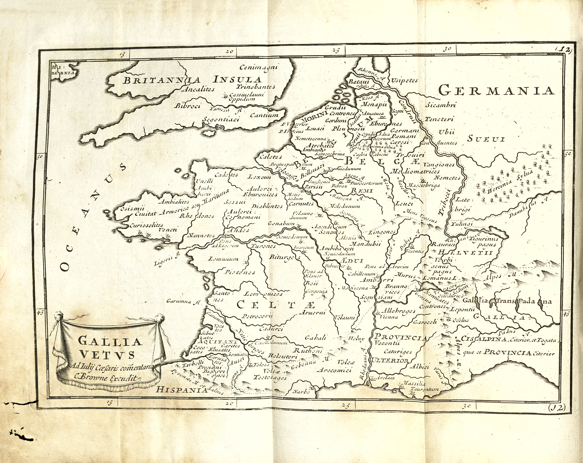
Map of the Gaul from Julius Caesar's C. Julii Caesaris Quae Exstant. Edition tertia. Londini: E [sic] typographaeo Mariae Matthews : Impensis J. & B. Sprint, B. Tooke, D. Midwinter, A. Bettesworth, J. Bowyer, H. Clements, Gul. Taylor, T. Ward, Gul. & J. Innys, & Gul. Churchill, 1719.
File history
Click on a date/time to view the file as it appeared at that time.
| Date/Time | Thumbnail | Dimensions | User | Comment | |
|---|---|---|---|---|---|
| current | 11:24, 8 June 2026 | | 2,048 × 1,626 (962 KB) | Lktesar (talk | contribs) | Map of the Gaul from Julius Caesar's ''C. Julii Caesaris Quae Exstant''. Edition tertia. Londini: E [sic] typographaeo Mariae Matthews : Impensis J. & B. Sprint, B. Tooke, D. Midwinter, A. Bettesworth, J. Bowyer, H. Clements, Gul. Taylor, T. Ward, Gul. & J. Innys, & Gul. Churchill, 1719. Category:Maps |
You cannot overwrite this file.
File usage
There are no pages that use this file.