File:BarthelemyTravelsOfAnacharsisV5Map1GreeceAndTheGrecianIslands.jpg
Jump to navigation
Jump to search
Size of this preview: 732 × 600 pixels. Other resolutions: 2,500 × 2,048 pixels | 5,000 × 4,096 pixels.
Original file (5,000 × 4,096 pixels, file size: 13.47 MB, MIME type: image/jpeg)
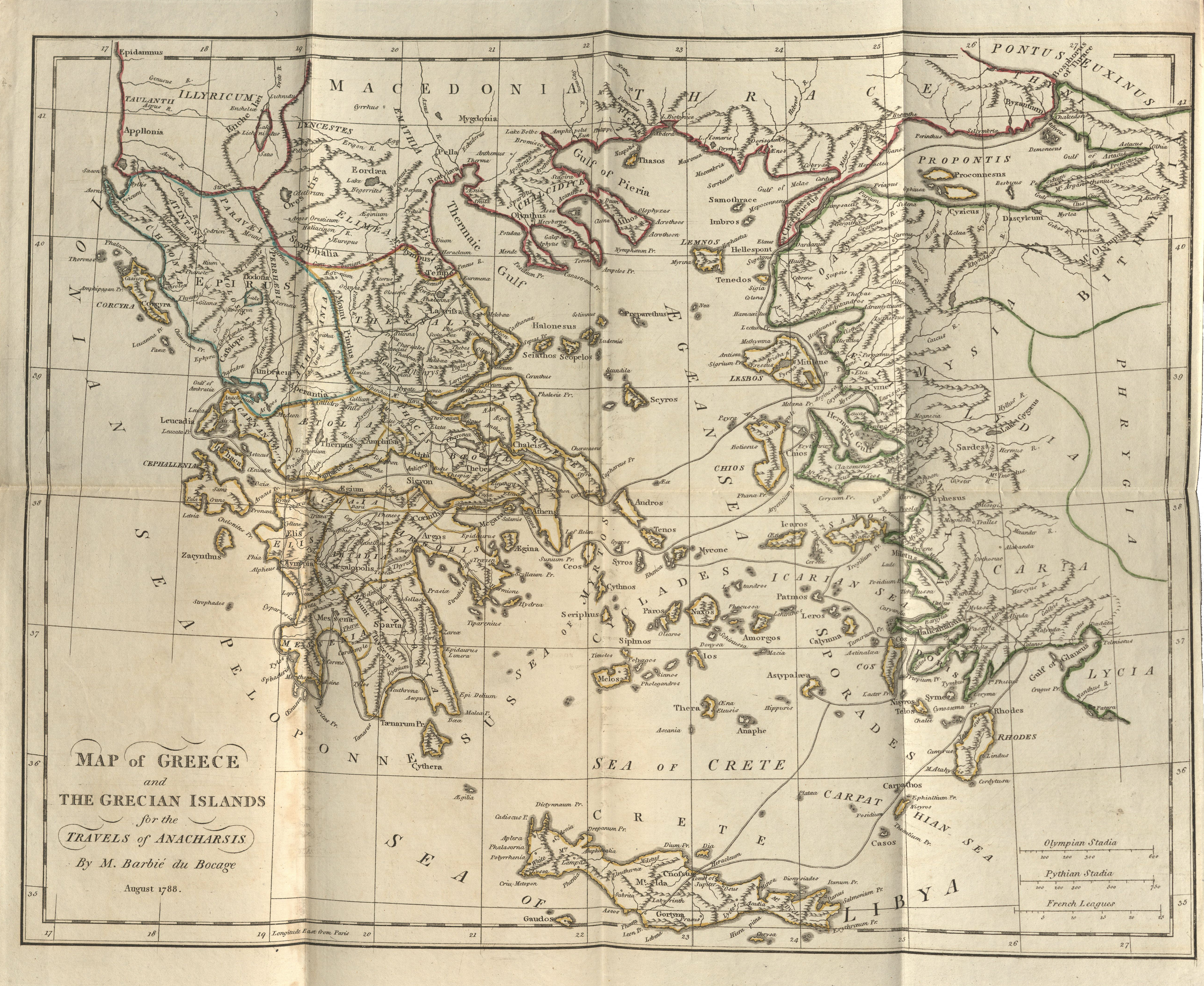
Map of "Greece and the Grecian Islands," from volume five of J.J. Barthelemy's Travels of Anacharsis the Younger in Greece, During the Middle of the Fourth Century before the Christian Æra. London: G.G. and J. Robinson, 1796.
File history
Click on a date/time to view the file as it appeared at that time.
| Date/Time | Thumbnail | Dimensions | User | Comment | |
|---|---|---|---|---|---|
| current | 16:35, 11 April 2023 | | 5,000 × 4,096 (13.47 MB) | Gwsweeney (talk | contribs) | Map of "Greece and the Grecian Islands," from volume five of J.J. Barthelemy's ''Travels of Anacharsis the Younger in Greece, During the Middle of the Fourth Century before the Christian Æra.'' London: G.G. and J. Robinson, 1796. |
You cannot overwrite this file.
File usage
There are no pages that use this file.